


Voting Districts not defined, Monmouth County, New Jersey
About
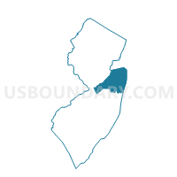
Outline

Summary
| Unique Area Identifier | 620547 |
| Name | Voting Districts not defined |
| County | Monmouth County |
| State | New Jersey |
| Area (square miles) | 139.97 |
| Land Area (square miles) | 0.00 |
| Water Area (square miles) | 139.97 |
| % of Land Area | 0.00 |
| % of Water Area | 100.00 |
| Latitude of the Internal Point | 40.34033550 |
| Longtitude of the Internal Point | -73.95790100 |
Maps


Graphs
Select a template below for downloading or customizing gragh for Voting Districts not defined, Monmouth County, New Jersey


Neighbors
Neighoring Voting District (by Name) Neighboring Voting District on the Map
- Voting District 2300000, Queens County, NY
- Voting District 6000051 6000052, Richmond County, NY
- Voting District 6000057, Richmond County, NY
- Allenhurst borough voting district 1, Monmouth County, NJ
- Asbury Park city voting district 4, Monmouth County, NJ
- Asbury Park city voting district 5, Monmouth County, NJ
- Asbury Park city voting district 6, Monmouth County, NJ
- Avon-by-the-Sea borough voting district 1, Monmouth County, NJ
- Avon-by-the-Sea borough voting district 2, Monmouth County, NJ
- Belmar borough voting district 1, Monmouth County, NJ
- Belmar borough voting district 2, Monmouth County, NJ
- Belmar borough voting district 3, Monmouth County, NJ
- Belmar borough voting district 4, Monmouth County, NJ
- Belmar borough voting district 5, Monmouth County, NJ
- Bradley Beach borough voting district 1, Monmouth County, NJ
- Bradley Beach borough voting district 2, Monmouth County, NJ
- Bradley Beach borough voting district 3, Monmouth County, NJ
- Bradley Beach borough voting district 4, Monmouth County, NJ
- Deal borough voting district 1, Monmouth County, NJ
- Keansburg borough voting district 6, Monmouth County, NJ
- Loch Arbour village voting district 8, Monmouth County, NJ
- Long Branch city voting district 16, Monmouth County, NJ
- Long Branch city voting district 8, Monmouth County, NJ
- Manasquan borough voting district 3, Monmouth County, NJ
- Middletown township voting district 29, Monmouth County, NJ
- Middletown township voting district 3, Monmouth County, NJ
- Middletown township voting district 36, Monmouth County, NJ
- Middletown township voting district 6, Monmouth County, NJ
- Middletown township voting district 7, Monmouth County, NJ
- Monmouth Beach borough voting district 1, Monmouth County, NJ
- Monmouth Beach borough voting district 2, Monmouth County, NJ
- Neptune township voting district 1, Monmouth County, NJ
- Neptune township voting district 2, Monmouth County, NJ
- Sea Bright borough voting district 1, Monmouth County, NJ
- Sea Bright borough voting district 2, Monmouth County, NJ
- Sea Girt borough voting district 1, Monmouth County, NJ
- Spring Lake borough voting district 3, Monmouth County, NJ
- Voting Districts not defined, Ocean County, NJ
Top 10 Neighboring County Subdivision (by Population) Neighboring County Subdivision on the Map
- Queens borough, Queens County, NY (2,230,722)
- Staten Island borough, Richmond County, NY (468,730)
- Middletown township, Monmouth County, NJ (66,522)
- Long Branch city, Monmouth County, NJ (30,719)
- Neptune township, Monmouth County, NJ (27,935)
- Asbury Park city, Monmouth County, NJ (16,116)
- Keansburg borough, Monmouth County, NJ (10,105)
- Manasquan borough, Monmouth County, NJ (5,897)
- Belmar borough, Monmouth County, NJ (5,794)
- Bradley Beach borough, Monmouth County, NJ (4,298)
Top 10 Neighboring Place (by Population) Neighboring Place on the Map
- New York city, NY (8,175,133)
- Long Branch city, NJ (30,719)
- Asbury Park city, NJ (16,116)
- Keansburg borough, NJ (10,105)
- Manasquan borough, NJ (5,897)
- Belmar borough, NJ (5,794)
- Bradley Beach borough, NJ (4,298)
- Ocean Grove CDP, NJ (3,342)
- Monmouth Beach borough, NJ (3,279)
- Spring Lake borough, NJ (2,993)
Top 10 Neighboring Elementary School District (by Population) Neighboring Elementary School District on the Map
- Oceanport Borough School District, NJ (7,244)
- Belmar Borough School District, NJ (5,794)
- Bradley Beach Borough School District, NJ (4,298)
- Monmouth Beach Borough School District, NJ (3,279)
- Spring Lake Borough School District, NJ (2,993)
- Avon-by-the-Sea Borough School District, NJ (1,901)
- Sea Girt Borough School District, NJ (1,828)
- Deal Borough School District, NJ (750)
Top 10 Neighboring Secondary School District (by Population) Neighboring Secondary School District on the Map
Top 10 Neighboring Unified School District (by Population) Neighboring Unified School District on the Map
- New York City Department Of Education, NY (8,175,133)
- Middletown Township School District, NJ (66,522)
- Long Branch City School District, NJ (30,719)
- Neptune Township School District, NJ (27,935)
- Ocean Township School District, NJ (27,485)
- Asbury Park City School District, NJ (16,116)
- Keansburg Borough School District, NJ (10,105)
- Manasquan Borough School District, NJ (5,897)
- Allenhurst Borough School District, NJ (496)
- School District Not Defined (Water), NJ (0)
Top 10 Neighboring State Legislative District Lower Chamber (by Population) Neighboring State Legislative District Lower Chamber on the Map
- General Assembly District 13, NJ (219,626)
- General Assembly District 10, NJ (208,227)
- General Assembly District 11, NJ (205,526)
- Assembly District 60, NY (126,132)
- Assembly District 23, NY (124,069)
- State House Districts not defined, NJ (0)
Top 10 Neighboring State Legislative District Upper Chamber (by Population) Neighboring State Legislative District Upper Chamber on the Map
- State Senate District 14, NY (323,939)
- State Senate District 24, NY (320,917)
- State Senate District 13, NJ (219,626)
- State Senate District 10, NJ (208,227)
- State Senate District 11, NJ (205,526)
- State Senate Districts not defined, NJ (0)
Top 10 Neighboring 111th Congressional District (by Population) Neighboring 111th Congressional District on the Map
- Congressional District 4, NJ (724,596)
- Congressional District 13, NY (686,525)
- Congressional District 6, NJ (668,806)
- Congressional District 9, NY (660,306)
Top 10 Neighboring Census Tract (by Population) Neighboring Census Tract on the Map
- Census Tract 8016, Monmouth County, NJ (5,522)
- Census Tract 8006.01, Monmouth County, NJ (5,472)
- Census Tract 8070.03, Monmouth County, NJ (4,998)
- Census Tract 8005, Monmouth County, NJ (4,477)
- Census Tract 8082, Monmouth County, NJ (4,298)
- Census Tract 8060, Monmouth County, NJ (4,170)
- Census Tract 8054, Monmouth County, NJ (4,115)
- Census Tract 8084.02, Monmouth County, NJ (3,605)
- Census Tract 8058, Monmouth County, NJ (3,581)
- Census Tract 8061, Monmouth County, NJ (3,550)
Top 10 Neighboring 5-Digit ZIP Code Tabulation Area (by Population) Neighboring 5-Digit ZIP Code Tabulation Area on the Map
- 07712, NJ (39,158)
- 07740, NJ (31,038)
- 07719, NJ (21,538)
- 08736, NJ (12,578)
- 07760, NJ (9,283)
- 07762, NJ (8,403)
- 07732, NJ (5,189)
- 07720, NJ (4,298)
- 08750, NJ (3,528)
- 07756, NJ (3,342)